During the Mediaeval period, the Gorslas area formed part of the commote of Iscennen, within the territory of the princes of Dinefwr. Although, by the later mediaeval period, Iscennen became part of the property of the Duchy of Lancaster, it was never subject to the degree of Normal settlement and remodelling of the landscape which marked the coastal lowlands of Carmarthenshire. Welsh settlement patters and Welsh land inheritance systems remained in place.
At least one part of the modern Gorslas community formed the Manor of Llanlluan, an estate owned by the Lord Bishop of St David. It is probable that the larger ecclesiastical parish of Llanarthney was created during this period. The area that is now known as Gorslas Community formed the southern portion of the parish and was served by the chapel-of-ease (a chapel-of-ease is a church building other than the parish church, built within the bounds of a parish for the attendance of those who cannot reach the parish church conveniently) of Llanlluan.
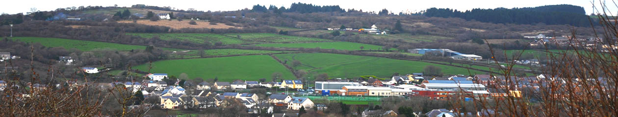
The only historic sites that can be said with any certainty to belong to the mediaeval period are the two recorded mediaeval chapels – Capel Llanlluan and Capel Erbach. It is notable that both are situated on the line of limestone ridge (as are two other chapels to the southwest – Capel Begewdin and Capel Dyddgen). These chapels were chapels-of-ease to parish churches such as Llanarthney and Llanddarog and their existence is undoubted proof that they served agricultural communities settled on adjacent lands. Their position therefore suggests that the better farmland along, and north of, the limestone belt was the focus of settlement.
Capel Llanlluan is of particular interest however, as in 1326 it is recorded by the ‘Black Book of St David’s’ as standing within the ‘Manor of Llanlluan’, owned by the Lord Bishop of St David’s. The ‘Black Book’ is a very important historical source as it described the tenants of each of the Lord Bishop’s estates and the duties that they had to fulfil in his service. It is quite possible that the area of irregular-shaped fields that can be seen today in the vicinity of the old chapel site is physical evidence of the fact that this pocked of land at the heart of the Llanlluan estate was under the plough in mediaeval times, whilst the higher ground that surrounds it formed ample mountain pasture where stock animals could be pastured for the summer months.
Most of the present community area would have been made up of the open moorland of Mynydd Mawr – a territory used primarily for the summer pasturing of stock and perhaps dotted with the hafotai (summer houses) of cowherds and shepherds. It is likely, however, that some woodland would have covered the limestone ridge that cuts through the middle of the area.
There are several place-names that may indicate mediaeval settlement or activity.
Rhydymaerdy, Cefneithin is an evocative name. In mediaeval times, the ‘maerdy’ (reeves’ settlement) was an important place, as the reeve or maer was responsible for the administration of the community. It is not known if there was a mediaeval ‘maerdy’ at this location. The boundaries of the mediaeval Manor of Llanlluan of the Lord Bishop of St David’s, mentioned above, included this area and it may be that the ‘maerdy’ referred to here was associated with the administration of the Manor (Rhydymaerdy is only just over 1 km south of the mediaeval chapel of Llanlluan).
A kilometre to the southwest of Rhydymaerdy is Neuadd Wen Farm. ‘Neuadd’ (hall) is a place-name that is also often associated with mediaeval settlement. There is a Neuadd Farm in the Amman Valley for example, which is known to have been the hunting lodge of the Lords of Dinefwr in mediaeval times. The origin of the name Neuadd Wen is also worthy of future study and its proximity to the mediaeval Llanlluan estate is worth bearing in mind.
There are two ‘castell’ place names in the community that also merit attention. There is no known castle or fort in the vicinity of the village of Foelgastell and therefore the origin of its name remains a mystery. The origin of the name of the Castell-y-Garreg limestone quarry, located northwest of Llyn Llech Owain has, however, been explained by a tradition that a mediaeval castle stood on a crag here, but that the crag and castle have been completely quarried away during recent centuries. There is no way of proving or disproving this tradition archaeologically, but the proximity of the evocatively-named village of Castell-y-Rhingyll (‘Serjeant’s Castle’) just outside the Gorslas community a kilometre to the southeast of Castell-y-garreg quarry raises the possibility of a link between the two places. There is no castle at Castell-y-Rhingyll and it is conceivable that the castle referred to by the name was indeed at the present site of the quarry.